

1
/
su
2
1762 L'Entree de la Riviere de Corentyn, map, Bellin, British Guiana, Suriname
1762 L'Entree de la Riviere de Corentyn, map, Bellin, British Guiana, Suriname
Prezzo di listino
€94,95 EUR
Prezzo di listino
Prezzo scontato
€94,95 EUR
Prezzo unitario
/
per
Imposte incluse.
Spese di spedizione calcolate al check-out.
Impossibile caricare la disponibilità di ritiro
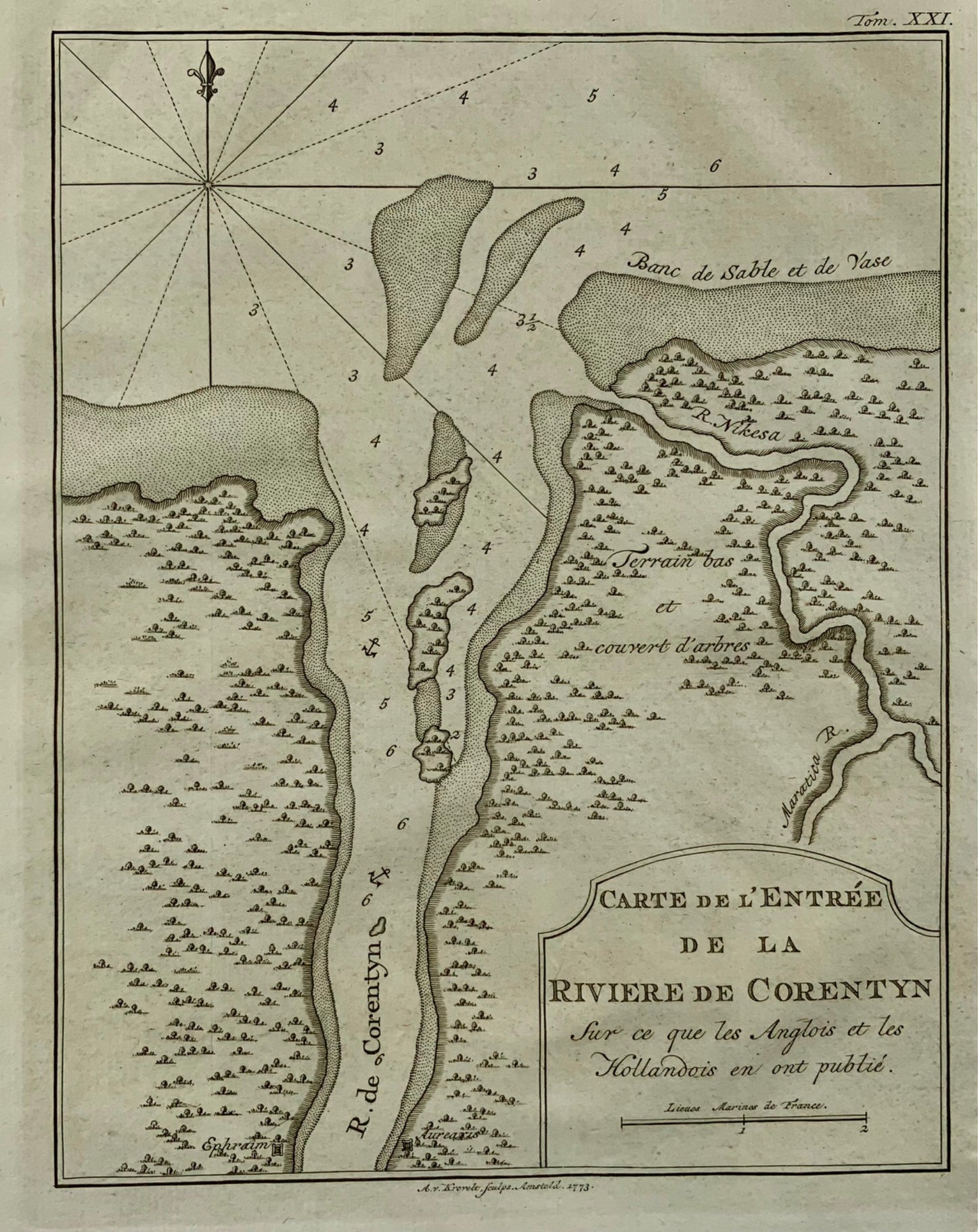
Jacques-Nicolas Bellin
Carte de L'Entree de la Riviere de Corentyn
Overall size: 25 x 20 cm
Published 1773.
A small but detailed chart of the mouth of the modern Courantyne River, which marks the border between Guyana, formerly British Guiana and Suriname.
Bellin, Jacques Nicolas "Plan de la Baye et Ville de Portobelo en 1736" Size: 12.9 x 7.5 inches 32.8 x 19.1 cm This attractive chart shows Portobelo, the important Spanish port city on the northern coast of Panama. Numerous soundings are located and a key at right identifies important locations. The chart is surrounded by a boldly engraved border. Not in Kapp's carto-bibliography of Panama.
Condividere

Iscriviti alle nostre e-mail
Iscriviti alla nostra mailing list per notizie privilegiate, lanci di prodotti e altro ancora.