1
/
su
2
Daniel Good Rare Books and Engravings
1758 Map of Courantyne River, Guyana & Suriname, Krevelt
Prezzo di listino
€78,95 EUR
Prezzo di listino
Prezzo scontato
€78,95 EUR
Prezzo unitario
/
per
Imposte incluse.
Spese di spedizione calcolate al check-out.
Impossibile caricare la disponibilità di ritiro
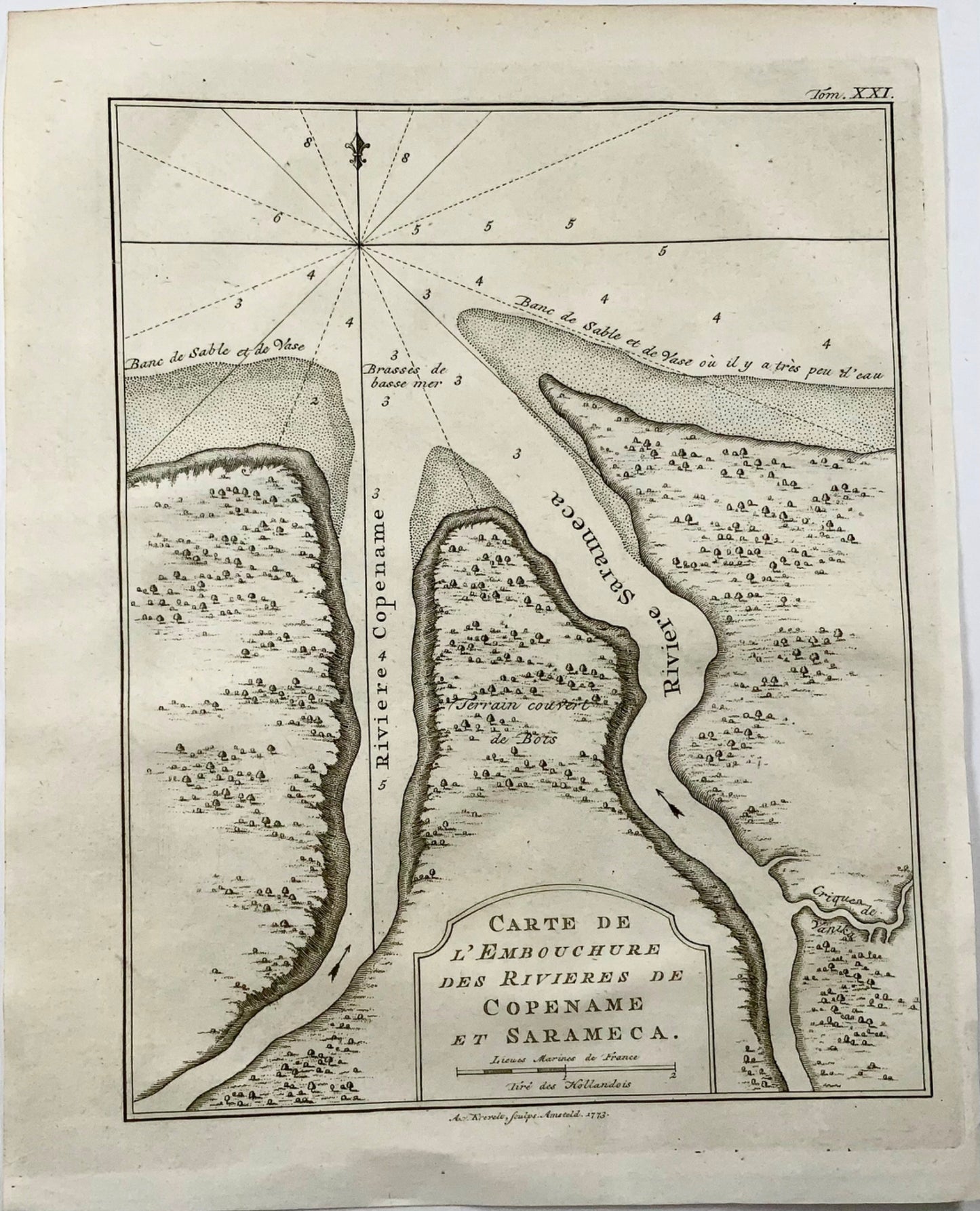
Krevelt, Abram van
‘Carte de l'Embouchure des Rivieres de Copename et Sarameca'
Published 1764.
Overall dimensions: 25 x 19.8 cm
A small but detailed chart of the mouth of the modern Courantyne River, which marks the border between Guyana, formerly British Guiana and Suriname.
Condividere
![1758 Map of Courantyne River, Guyana & Suriname, Krevelt](http://rarebooksandprints.com/cdn/shop/files/img6091.jpg?v=1719403227&width=1445)
![1758 Map of Courantyne River, Guyana & Suriname, Krevelt](http://rarebooksandprints.com/cdn/shop/files/img6090.jpg?v=1719403227&width=1445)
Iscriviti alle nostre e-mail
Iscriviti alla nostra mailing list per notizie privilegiate, lanci di prodotti e altro ancora.