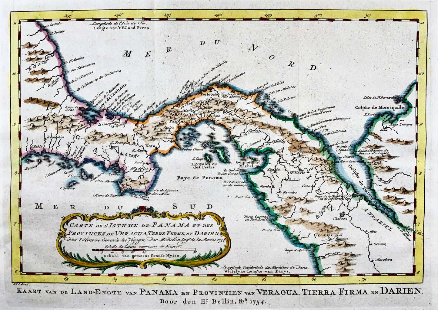
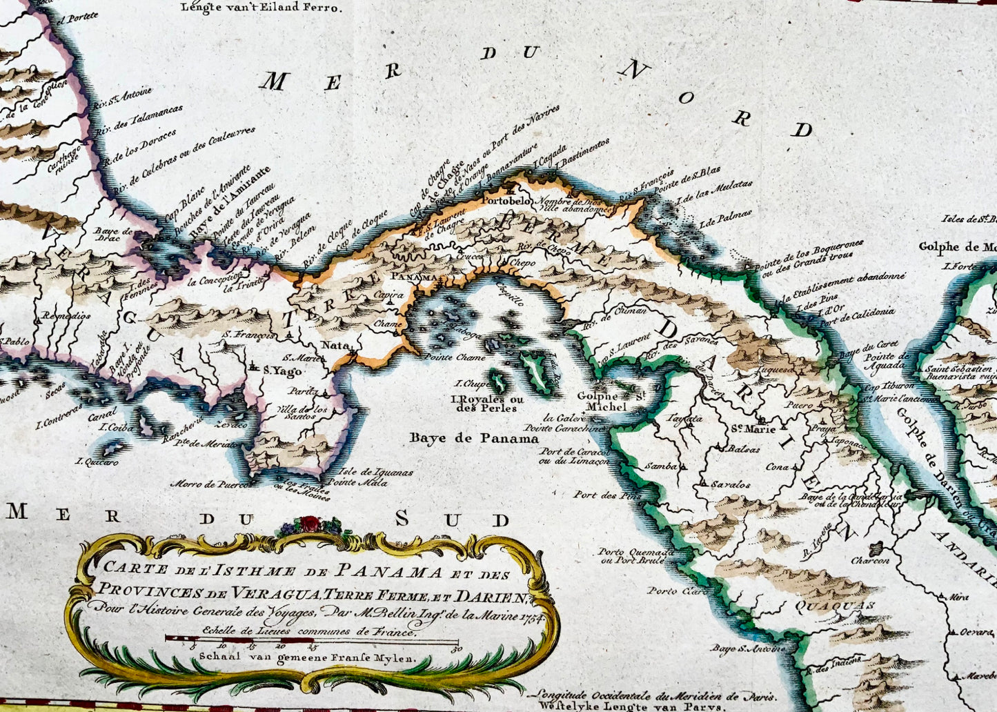
1754 Schley, Bellin, map of Panama, Gulf of Darien, Central America
1754 Schley, Bellin, map of Panama, Gulf of Darien, Central America
Couldn't load pickup availability
Bellin, Jacques Nicolas; Jak. Von Schley
"Carte de l'Isthme de Panama et des Provinces de Veragua, Terre Ferme, et Darien. Pour l'Histoire Generale des Voyages"
Size:
11.5 x 7.6 inches
29.2 x 19.3 cm
An attractive map featuring good detail of Panama many years before the creation of the Canal and Lake Bayano. Numerous place names including S. Yago on the Azuevo Peninsula, Portobelo, Se. Marie, Panama, etc. Extends to include the Gulf of Darien. Adorned with a delicate title cartouche. This map was published in a Dutch edition of Antoine Francois Prevost d'Exiles' influential collection of travel narratives, L'Histoire Generale des Voyages. Alternate Dutch title below the map: Kaart van de Land-Engte van Panama en Provintien van Veragua, Tierra Firma en Darien.
References: Kapp (MCC-73) #74.