Daniel Good Rare Books and Engravings
1780 Bonne - DOUBLE HEMISPHERE WORLD MAP - hand coloured engraved map
Couldn't load pickup availability
Rigobert Bonne.
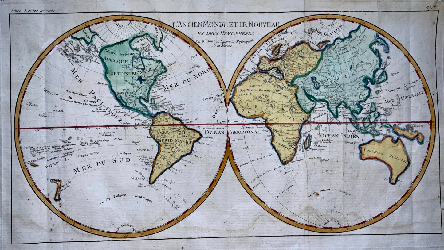
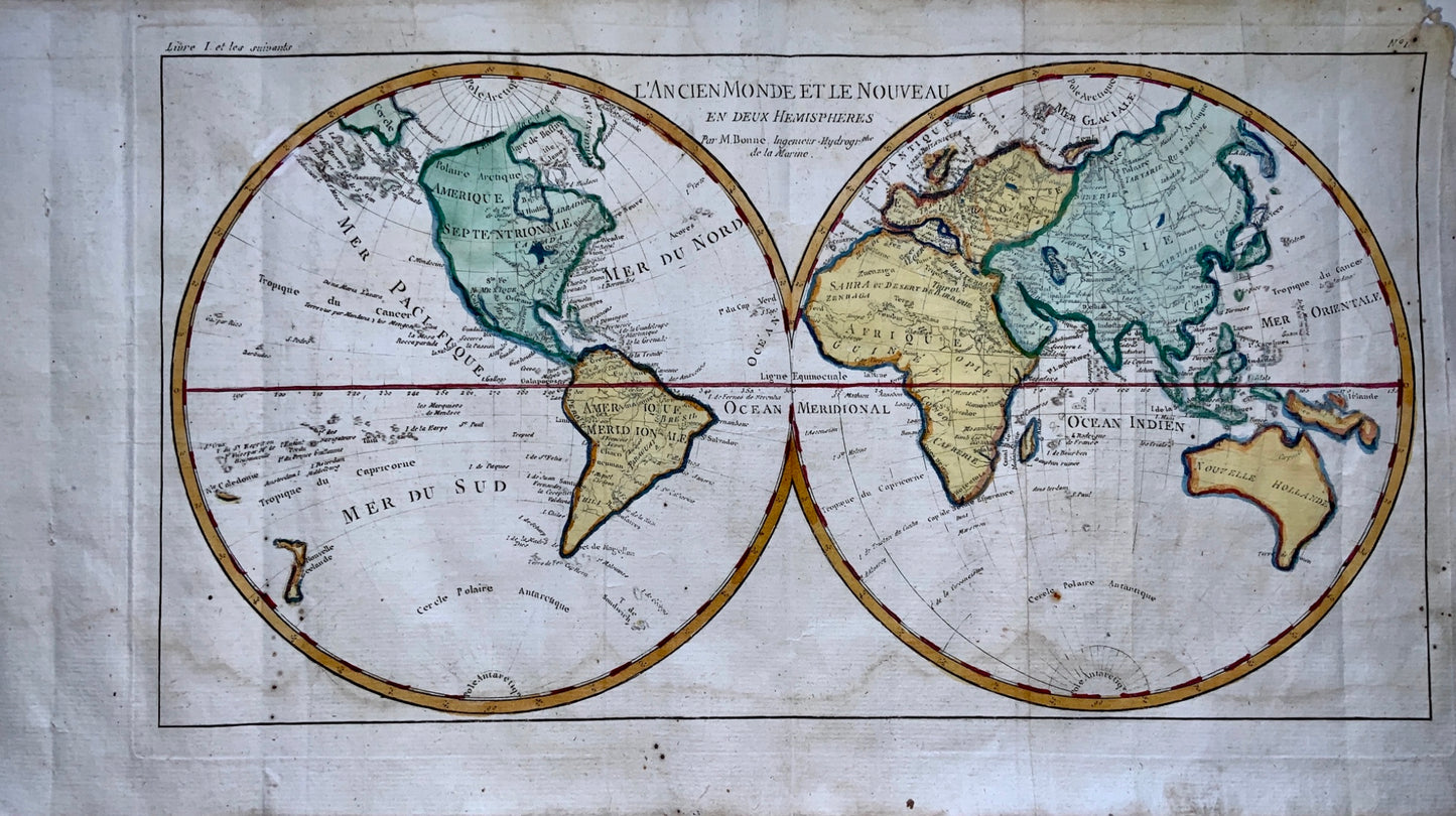
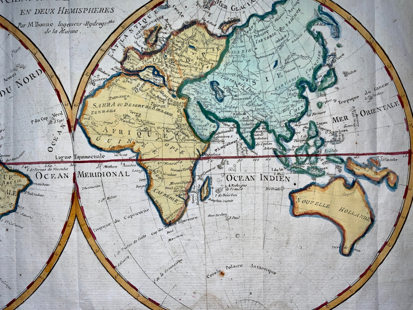
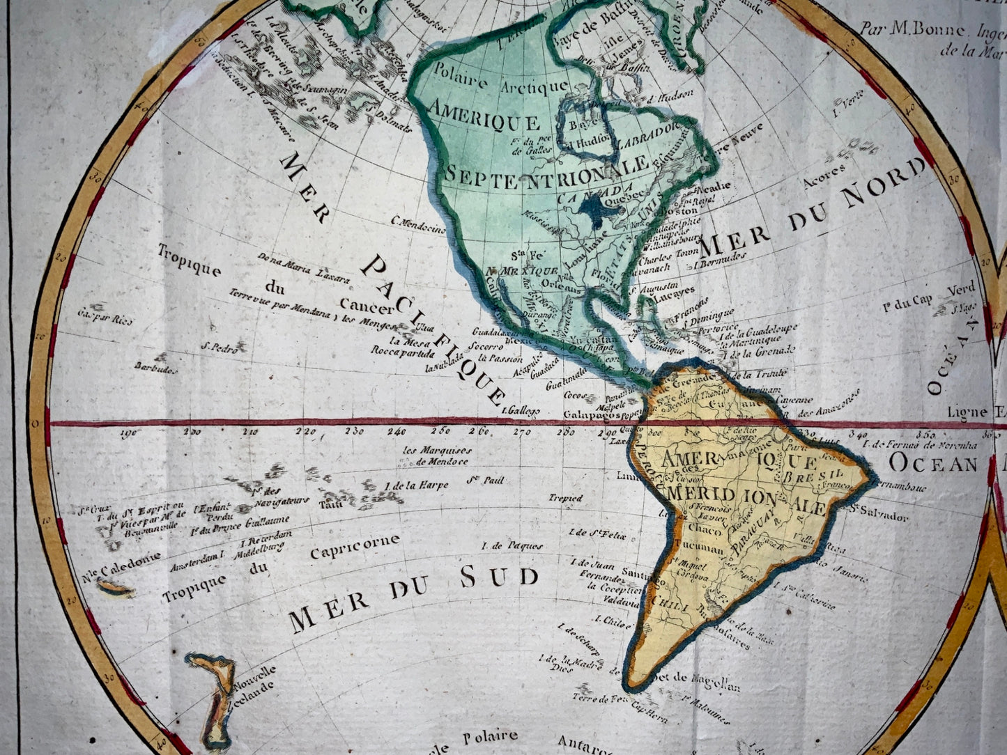
"L'Ancien Monde et le Nouveau en Deux Hemispheres"
From Bonne's Atlas de toutes les parties connues du Globe Terrestre. Paris, 1780.
Size: 8.4 x 12.5 inches; 21.3 x 31.8 cm
Engraving.
Attractive double hemisphere world map. In North America, the United States is named and confined along the eastern seaboard. The entire western region is blank with the only place name being Cape Mendocino. There is a large group of islands in the North Pacific including Alaschka in the vicinity of Alaska. Tasmania is attached to Australia and both islands of New Zealand are depicted.
Very good condition. Minor wear to outer margin.
Share
![1780 Bonne - DOUBLE HEMISPHERE WORLD MAP - hand coloured engraved map](http://rarebooksandprints.com/cdn/shop/products/ae406a22-6b49-437a-ad6a-f2e91a41a90c.jpg?v=1630082392&width=1445)
![1780 Bonne - DOUBLE HEMISPHERE WORLD MAP - hand coloured engraved map](http://rarebooksandprints.com/cdn/shop/products/1edf39c7-898b-4855-b044-c42aa51c6ae4.jpg?v=1630082392&width=1445)
![1780 Bonne - DOUBLE HEMISPHERE WORLD MAP - hand coloured engraved map](http://rarebooksandprints.com/cdn/shop/products/b9376e98-868d-436b-b403-3e5d7cce2a87.jpg?v=1630082392&width=1445)
![1780 Bonne - DOUBLE HEMISPHERE WORLD MAP - hand coloured engraved map](http://rarebooksandprints.com/cdn/shop/products/99f88e20-860d-46f4-8a77-51c631b669c4.jpg?v=1630082392&width=1445)
Subscribe to our emails
Subscribe to our mailing list for insider news, product launches, and more.