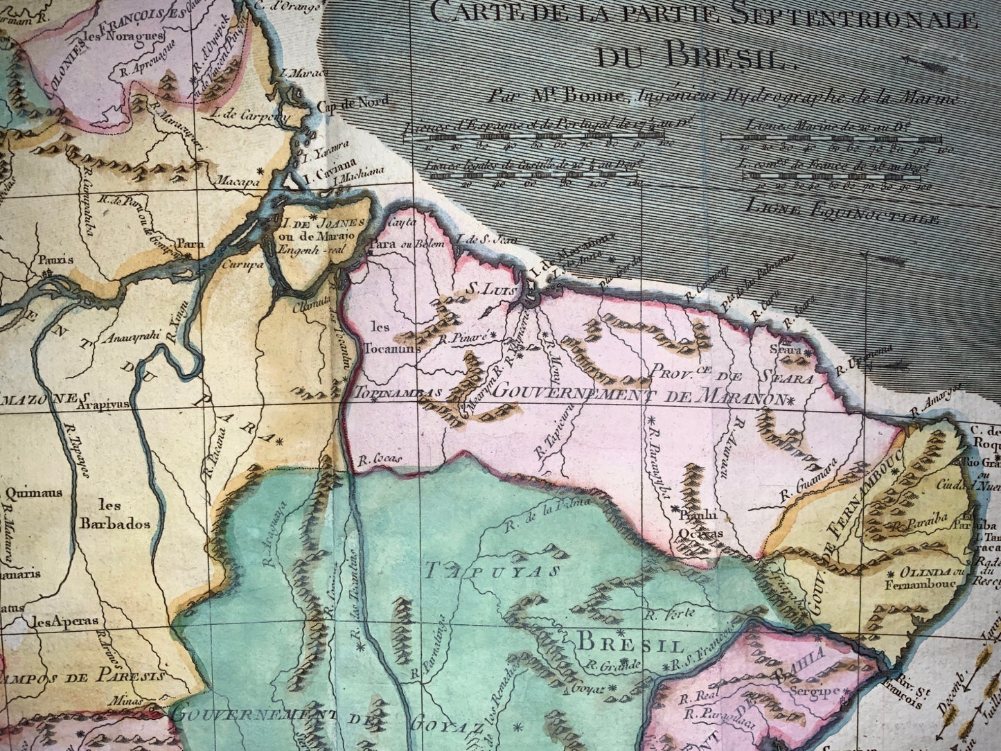
From Bonne's Atlas de toutes les parties connues du Globe Terrestre. Paris, 1780.
Size: 8.4 x 12.5 inches; 21.3 x 31.8 cm
Engraving.
A nicely scaled map of the upper part of Brazil, covering the coast from Cayenne to just south of Salvador. It has an interesting representation of the Mouth of the Amazon and tracks the Amazon River westward. Great topographiocal detail and delineation of political subdivisions.
Very good condition. Minor staining to very upper margin above plate line.